Key Takeaways
- Edouard made landfall at 2:20 p.m. Tuesday near Johnson Bayou, Louisiana, about 15 miles south-southeast of Port Arthur, Texas, with 60 mph sustained winds, per the National Hurricane Center.
- The National Weather Service said 10 to 21 inches of rain had fallen as of early Wednesday inside the Flash Flood Emergency in Hardin and Tyler counties.
- Outage counts depend on the clock: FOX Weather reported more than 70,000 without power; the Houston Chronicle said more than 56,800 were still out early Wednesday.
- A top gust of 90 mph was measured in Port Arthur, and a dozen school districts east of Houston closed Wednesday.
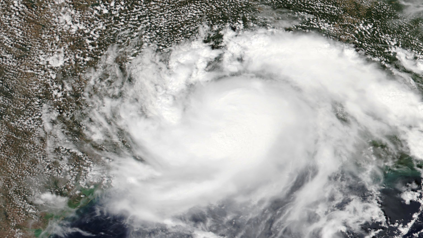
Edouard is no longer a tropical storm, but the water it left behind is still the emergency. The system came ashore Tuesday afternoon near Johnson Bayou, Louisiana, then crawled inland and unloaded enough rain on Southeast Texas to trigger a life-threatening Flash Flood Emergency in parts of Hardin and Tyler counties early Wednesday. A Flood Watch runs through Wednesday evening for much of the region, including Houston — and every figure below is a snapshot from a moving story.
A 2:20 p.m. landfall, and a storm that nearly became a hurricane
Edouard made landfall at 2:20 p.m. local time Tuesday near Johnson Bayou, Louisiana — about 15 miles south-southeast of Port Arthur, Texas — with maximum sustained winds of 60 mph and a minimum central pressure of 996 mb, FOX Weather reported, citing the National Hurricane Center. The Weather Channel logged the same landfall.
It came close to being something bigger. FOX 26 Houston noted that if Edouard had produced winds of at least 74 mph, it would have been the first hurricane of the 2026 Atlantic season — one still waiting on its first hurricane well into its usual peak. The FOX Forecast Center said the inner core formed “only a segment of an eye-wall on the southwest side of the storm,” enough to lift winds from 40 mph to 60 mph and no further.
The wind still hit hard in places. FOX Weather reported a top gust of 90 mph in Port Arthur and two other hurricane-force gusts in the area Tuesday, though The Weather Channel called a post-landfall gust reported near Port Arthur on Sept. 1 unofficial. The Weather Channel also logged 71 mph near the Texas/Louisiana border and 52 mph at Calcasieu Pass, Louisiana. The two FOX outlets differ on the downgrade time: FOX Weather said Edouard became a tropical depression at 10 p.m. Tuesday, FOX 26 Houston said around 9:30 p.m.
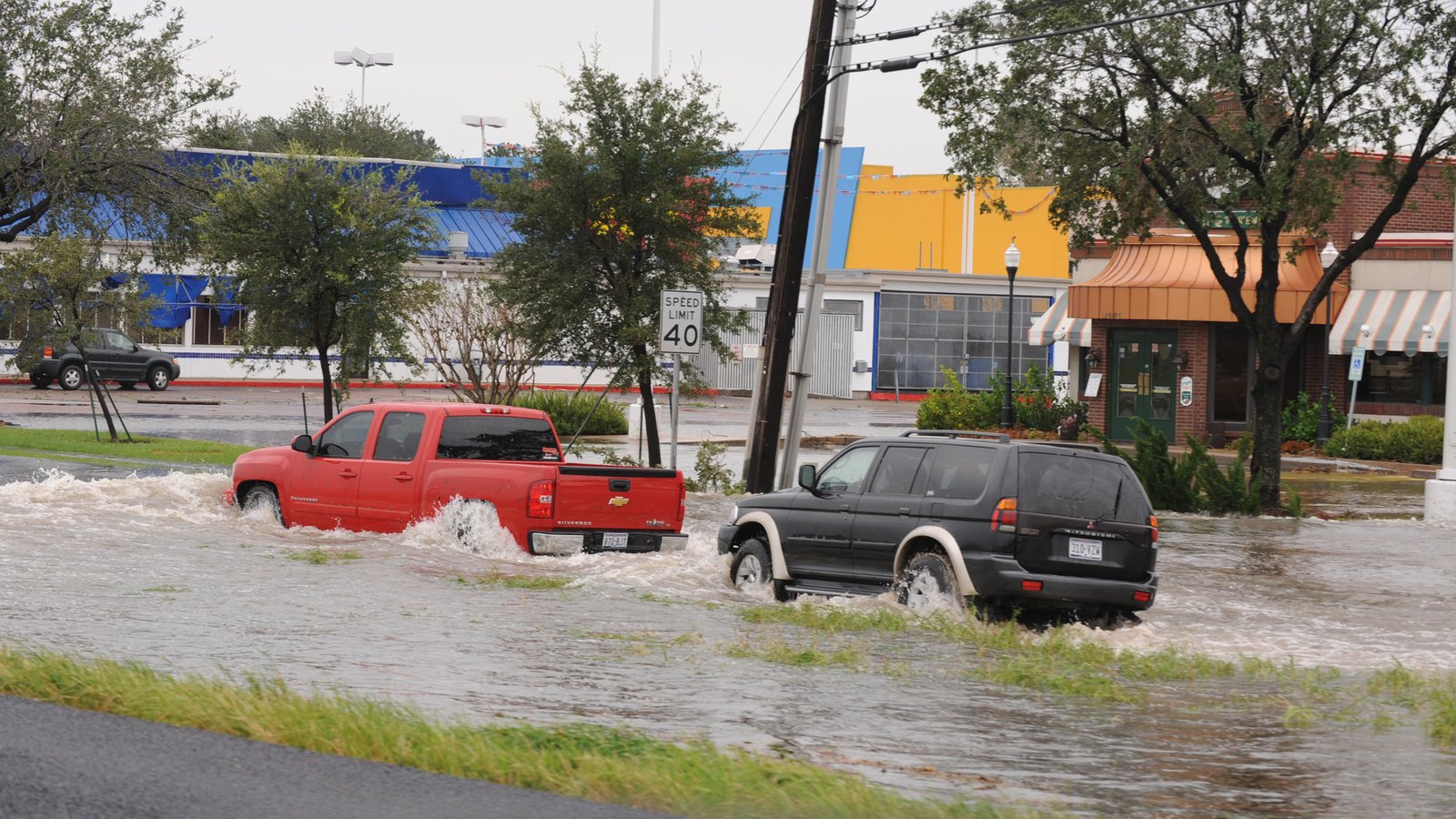
The Flash Flood Emergency is the part to take seriously
A Flash Flood Emergency for life-threatening flooding was issued for parts of Hardin and Tyler counties shortly after 5:45 a.m. local time, according to FOX Weather. The National Weather Service said 10 to 21 inches of rain had fallen across that area as of early Wednesday, and urged people in the Kountze, Village Mills and Honey Island communities to seek higher ground immediately.
Around that core, a Flash Flood Warning was in effect early Wednesday for Hardin, Jefferson, Tyler, Chambers, Liberty, Polk and San Jacinto counties. Wider still is the Flood Watch that FOX Weather said runs through Wednesday evening — an alert FOX 26 Houston reported had gone up for much of Southeast Texas, including the Houston metro area.
Local officials kept their instructions narrow. Kountze city officials said on social media that power lines were down and flooding was ongoing early Wednesday, and asked people to avoid travel. The Jefferson County Commissioner shared video of downed trees that had taken power lines with them late Tuesday and asked people to stay off the roads. Port Arthur emergency management officials said they were investigating widespread reports of a gas odor as the storm came ashore.
Two power-outage numbers, and why both can be right
You will see two very different outage figures attached to the same storm, and the gap is mostly about when and where each figure was counted. FOX Weather reported more than 70,000 customers without power as Edouard moved inland. The Houston Chronicle said more than 56,800 utility customers still had no power early Wednesday.
The Chronicle’s own framing dates its number: districts were closing, it wrote, “most citing power outages that impacted over 70,000 customers in the Beaumont area Tuesday night.” FOX Weather, though, was still reporting its own 70,000-plus figure on Wednesday. Neither outlet published a running regional total, so read the two figures as different timestamps and footprints; that reading is ours, not theirs.
Carry that into any outage number you read today. Utility counts are live dashboards, not final tallies — they fall as crews restore circuits and climb again when another saturated tree comes down. For your own address, your utility’s outage map is the only current number.
Schools closed, city buildings opened late
The closure list shows where the damage concentrated. The Houston Chronicle reported that Beaumont ISD and several surrounding districts shut down for a second straight day, and listed the districts closed Wednesday east of Houston: Beaumont ISD, Hardin-Jefferson ISD, Kountze ISD, Little Cypress-Mauriceville CISD, Lumberton ISD, Nederland ISD, Orangefield ISD, Port Arthur ISD, Port Neches-Groves ISD, Silsbee ISD, Vidor ISD and West Orange-Cove CISD. Conroe and Willis ISDs, north of Houston, also canceled Wednesday classes.
FOX Weather added that the Woodville Independent School District and several others nearby canceled school Wednesday, and that Port Arthur ISD would stay closed to assess damage to infrastructure. Beaumont said city facilities would not open until noon while crews cleared debris.
Port Arthur and Jefferson County had both issued disaster declarations ahead of the storm to speed up anticipated cleanup, FOX Weather reported.
Houston’s heaviest rain comes as the center passes
For the Houston metro, the worst hours were still ahead Wednesday morning. The FOX Forecast Center said the heaviest rain would fall inland through midday Wednesday as the storm’s center moved somewhat along the Interstate 45 corridor. “The highest rain totals will be somewhere north and east of the Houston Metro and east of I-45,” it said, with totals that “could be as high as 8-10 inches in some spots, but most will see a generous 3-5 inches of rain.”
The Houston Chronicle described the same setup from ground level: heavy rain with lightning and gusty winds, and bands repeatedly crossing the same ground that could drop more than 10 inches along a slim region between Liberty and Huntsville, with water rising fast on streets and in low-lying areas. Before landfall, ABC News had forecast 2 to 4 inches near the coast, up to 6 to 9 inches north of Houston, a 1-to-3-foot storm surge and a possible tornado or two.
Louisiana is still in this. The Weather Channel reported water levels 1 to 2 feet above expected tidal levels in southwestern Louisiana and said the flood threat continues in both states; ABC News expected heavy rain in southwest Louisiana through Wednesday.
What happens next
The system itself is forecast to come apart: FOX 26 Houston, citing the NHC, said Edouard would keep moving northwest through Wednesday morning before dissipating. That does not end the flood risk — the Flood Watch runs through Wednesday evening, and repeating rain bands put water on streets after the wind is gone.
For the season, Edouard is a marker rather than a turning point. The Weather Channel said it became the fifth named storm of 2026. FOX Weather counted it as the season’s third landfall, after Tropical Storm Arthur near Matagorda County, Texas, on June 17 and Tropical Storm Bertha in St. Bernard Parish, Louisiana, on July 22 — all three on the northwestern Gulf Coast. The Weather Channel’s advice holds: “while we expect a quieter hurricane season, you should have your hurricane safety plan ready to go and monitor forecasts throughout the season.”
More: El Niño could break the record · the Old Farmer’s Almanac winter outlook
Quick poll
What worries you most in a storm like Edouard?
Edouard's sustained winds peaked at 60 mph, but the National Weather Service reported 10 to 21 inches of rain inside the Flash Flood Emergency area.
FAQ
Where did Tropical Depression Edouard make landfall? It came ashore as a tropical storm at 2:20 p.m. local time Tuesday near Johnson Bayou, Louisiana, about 15 miles south-southeast of Port Arthur, Texas, with 60 mph sustained winds, per FOX Weather.
Is Houston under a flood warning? Houston sits inside a Flood Watch that FOX Weather said runs through Wednesday evening. The Flash Flood Warning early Wednesday covered Hardin, Jefferson, Tyler, Chambers, Liberty, Polk and San Jacinto counties.
How many people are without power in Texas? It depends on the timestamp. FOX Weather reported more than 70,000 customers out as Edouard moved inland; the Houston Chronicle said more than 56,800 were still out early Wednesday.
Was Edouard ever a hurricane? No. FOX 26 Houston reported it would have been the season’s first hurricane at 74 mph, but it peaked at 60 mph sustained and weakened to a tropical depression Tuesday night.