Key Takeaways
- The American Samoa expedition is scheduled August 20–September 17, with public live video during planned operations.
- NOAA describes a general viewing window around 3 p.m.–3 a.m. Eastern Daylight Time, subject to the day's plan.
- The livestream page and expedition overview differ on the last planned streaming date; use the current dive update.
- Science discussion is on the right audio channel and ROV-pilot audio on the left during dives.
NOAA is exploring deep waters around American Samoa aboard the Okeanos Explorer, and the public can watch scheduled remotely operated vehicle dives online. The expedition runs August 20 through September 17, 2026, combining close-up seafloor exploration with mapping and participation by scientists ashore.
The most useful viewing advice is to check the current dive update before settling in. NOAA’s expedition and livestream pages give different planned end dates for routine streaming, and both say plans can change. The overall voyage dates are not a guarantee of twelve hours of underwater video every day.
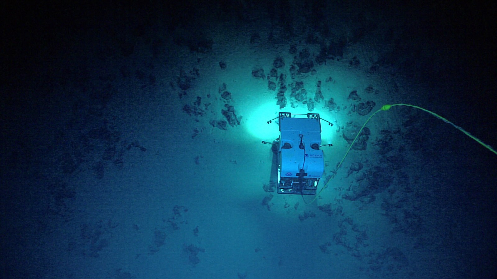
Hero: NOAA Ocean Exploration, 2026 American Samoa ROV + Mapping Exploration. Deep Discoverer during Dive 02. Source · Media-use policy. Cropped and JPEG-optimized.
Start with the official live page
NOAA’s live-video page brings together three camera streams, the current operational update, and an explanation of what viewers are hearing and seeing. It is the best starting point because a circulating video link can outlast the specific operation it originally showed.
The official Camera 1 stream is embedded below. If it is quiet, shows another part of the operation, or later becomes an archive, return to NOAA’s current live page. A ship can still be conducting an expedition while its remotely operated vehicles are out of the water.
This is a window into fieldwork rather than a scheduled entertainment program with a guaranteed reveal. A dive may involve transit, navigation, careful inspection, sampling, and long stretches of observation. Those quieter sequences explain how the expedition collects useful evidence.
Read the daily plan, especially its time zone
NOAA describes a broad daily streaming window of approximately 8 a.m.–8 p.m. Samoa Standard Time, corresponding to 3 p.m.–3 a.m. Eastern Daylight Time. The daily update can list more specific estimates for vehicle launch, seafloor arrival, and departure.
As reviewed September 5, the expedition overview says routine streaming is planned through September 15, while the live page says through September 12. This is an unresolved difference between the two official pages, not a reason to choose the longer schedule and present it as certain.
Use the most recent dive update for an actual viewing session. It separates launching the vehicle from arriving at the seafloor, which helps explain why an early viewer might not immediately see animals or rocks. All of those times remain subject to change.
Also notice that the Eastern viewing window crosses midnight. An evening dive watched from the US mainland can continue into the next calendar day there. The date printed on a dive update and the date on your wall calendar may therefore differ without either being wrong.
What the expedition is trying to learn
The expedition overview describes work to map, explore, and characterize little-studied deepwater regions in and around American Samoa. The territory lies roughly 2,200 miles southwest of Hawaii and includes extensive ocean areas whose deep habitats and geology remain incompletely understood.
The planned ROV dives range from approximately 2,000 to 6,000 meters deep. NOAA expects to investigate seamount habitats, deep-sea coral and sponge communities, fish habitats, the water column, and abyssal plains, including areas with polymetallic nodules.
These targets produce different kinds of observations. A wide seafloor view can show habitat structure. A close-up can reveal an animal associated with a coral. A sample gives scientists material to analyze after the camera has moved on. No single dramatic frame supplies all of that context.
NOAA says mapping data will help plan dives, guide future exploration, establish environmental baselines, and inform management decisions. The purpose includes understanding places and resources, not simply collecting unusual-looking creature videos.
Mapping and close-up diving answer different questions
The ship uses multibeam sonar to survey areas with little or no high-quality mapping data. The expedition includes overnight mapping operations as well as ROV dives, building on earlier work in the region.
A map provides a broader picture of the seafloor’s shape and helps identify where to look closely. An ROV supplies images and observations at a much smaller scale. The two activities complement each other: a camera cannot efficiently replace a wide-area survey, and a map cannot show every detail visible during a close inspection.
That distinction helps viewers interpret a changing feed. A period without a close-up underwater scene does not necessarily mean that all useful work has stopped. The current operational description tells you what kind of work is underway.
It also separates this experience from a visualization such as NASA’s Eyes. Eyes lets you move a virtual camera through a model. NOAA’s stream shows the field equipment’s actual view and operational constraints.
The tiny red dots provide a scale reference
NOAA says viewers will sometimes see two red laser points in the camera image. They are ten centimeters—almost four inches—apart and help scientists estimate the sizes of objects being observed.
Without a scale reference, a close-up can make a small organism seem enormous or a large structure seem modest. The dots add measurement context to a scene that otherwise lacks familiar objects such as a ruler or a human hand.
Do not interpret every spoken identification as a final scientific finding. Scientists are discussing observations as the dive unfolds. The stream lets the public hear that process, while the expedition’s published captions, summaries, and archived data provide the more durable record.
Why the audio may sound uneven
The live page explains that audio is available during dives when the ROVs are in the water. On all three streams, scientific participants are assigned to the right audio channel and the pilots to the left.
That arrangement matters if you listen with one earbud or have a speaker balance setting favoring one side. Missing part of the conversation might reflect the channel configuration rather than a silent science team. Check both channels before deciding the feed has lost audio.
For a classroom or family viewing session, choose a specific observation to follow: what the team is trying to inspect, how the vehicle approaches it, or what changes when a sample is collected. That gives the slower parts of fieldwork a purpose beyond waiting for a striking animal to appear.
What happens next
The voyage is scheduled to continue through September 17. NOAA plans work both inside and outside protected areas including the National Marine Sanctuary of American Samoa and Rose Atoll Marine National Monument, with dive locations and objectives identified during operations.
Collected data are intended for public archives; the expedition page says Okeanos Explorer data are submitted within 120 days after completion. That is an archive-delivery window, not a claim that every result is already available while the ship is at sea.
For viewers, the next step is straightforward: check the official daily update, open the appropriate stream, and keep the location, time, and observation context attached when sharing a clip. If you prefer an outdoor science activity, our September night-sky guide covers a different set of observation opportunities.
Quick poll
Which part of a deep-ocean dive would you watch longest?
Our take: keep the dive date and location with a shared clip so an observation retains its context.
FAQ
Where can I watch the expedition?
Use NOAA Ocean Exploration’s official live-video page, which links the camera feeds and current dive information.
Is there a live dive every day until September 17?
Not necessarily. September 17 is the planned voyage end; the two official pages give different routine streaming end dates and both allow schedule changes. Check the daily update.
What are the two red dots?
NOAA says they are laser points ten centimeters apart, providing a scale reference for objects in the view.
Why can I hear pilots but not scientists?
During dives, the pilot channel is on the left and science participants are on the right. Check both audio channels; audio is not expected throughout every operation.